PG Ranch: Advancing Wildlife Conservation Through Innovative Data Collection
PG Ranch spans 9,500 acres in the breathtaking Bitterroot Valley, dedicated to ecological, biological, and environmental study and education. In their quest to enhance wildlife habitats, PG Ranch engaged GCS to develop a robust method for collecting field data, uploading it to ArcGIS, and conducting comprehensive analyses and reports on the database.


Challenges in Habitat Restoration
PG Ranch invests hundreds of thousands of dollars annually in landscape restoration efforts, which include:
- Planting and seeding
- Building earth banks to manage drainage
- Constructing fences to protect against grazing wildlife
Despite these significant investments, researchers needed to assess the effectiveness of their restoration initiatives and identify the most impactful treatments for wildlife.

Innovative Solution: iPad Data Collection System
After exploring various options, including Trimble GPS devices with ArcPad, GCS implemented a cutting-edge iPad solution. This system integrates high-resolution aerial imagery of the ranch (at a 6-inch ground scale), sensitive GPS capabilities, and seamless synchronization with an ArcGIS geodatabase. The intuitive touchscreen controls streamline wildlife observation collection and analysis, enabling biologists to work more efficiently.
Key Features of the iPad System:
- Direct Data Integration: Collected data is directly funneled into ArcGIS for immediate analysis.
- User-Friendly Interface: Researchers can easily record “observation sessions” using the iPad app, which displays exact GPS positions over high-resolution imagery.
- Non-Intrusive Observation: The app allows researchers to determine observational distances without descending into potentially disruptive areas, protecting delicate habitats and minimizing wildlife disturbance.
- Offline Functionality: Sessions can be recorded offline and synced once back within Wi-Fi coverage, ensuring seamless data management.

Impactful Research and Findings
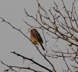
The iPad app and desktop analysis tools have been instrumental for various research projects on PG Ranch. One notable study focused on songbird populations during fall migration in unique habitats known as “shrubby draws,” which are linear areas that follow gullies and offer limited cover amid grasslands.
Researchers recorded vital information during each observation session, including:
- Bird species identified
- Exact location of sightings
- Vegetation usage
With geo-referenced data, the team tracked patterns in bird occurrence, abundance, and diversity over time and space. This innovative approach enables researchers to examine bird utilization of specific areas and small-scale features.

Guiding Future Restoration Efforts
The insights gained from this research will guide further restoration projects in the shrub draws and provide a quantitative means of evaluating the effectiveness of various restoration treatments. By harnessing advanced technology, PG Ranch and GCS are paving the way for more effective wildlife conservation and habitat restoration efforts.

You must be logged in to post a comment.