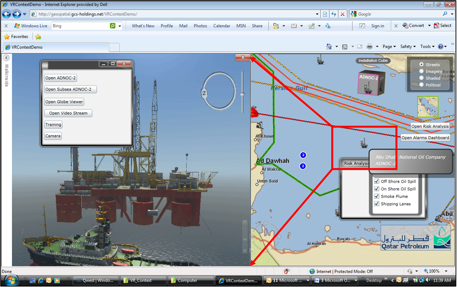
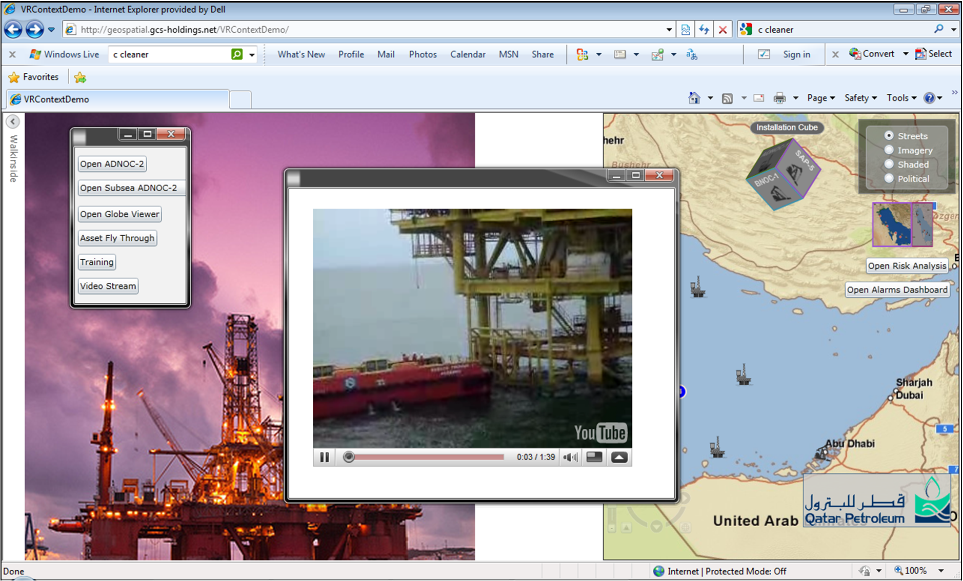
In partnership with VRcontext International, GCS developed an innovative “proof of capability” solution integrating ESRI ArcGIS technology into VRcontext Walkinside, a virtual reality asset management client. This prototype merges the powerful capabilities of ArcGIS Server with complex 3D asset models in Walkinside. By leveraging a Service-Oriented Architecture (SOA) and incorporating the Google Maps API, the solution provides seamless GIS integration into a Common Operational Picture (GeoCOP), enhancing situational awareness for asset management and real-time monitoring.

Key Features:
- ArcGIS Integration: The prototype connects ArcGIS Server with Walkinside, allowing users to interact with 3D models of critical assets.
- Real-time Sensor Feeds: Integrated sensor streams from stationary and mobile platforms, including digital video, provide enhanced security and situational analysis for building and asset layouts.
- Microsoft Silverlight Web Portal: GCS developed a high-performance web portal for visualization, offering flexibility, scalability, and real-time data access. The portal supports a global scope, combining static events with dynamic, live feeds for cost-effective infrastructure management.
- Google Earth API Integration: By integrating Google Earth API, GCS developed KML-based representations of assets geospatially referenced to real-world coordinates. This enables users to interact with 2D maps and 3D models for regional situational awareness.
- Video Integration: The system includes live feeds from IP-addressable cameras and other data streams, such as UAV or underwater robotic monitoring devices, enabling users to view asset conditions and security footage in real-time.
Enhanced Visualization and Monitoring
The solution enables users to select and interact with oil and gas platforms, accessing highly detailed 3D engineering models in Walkinside. Additionally, live video feeds from on-site cameras can be accessed by clicking corresponding icons within the model, offering a comprehensive view for remote monitoring and security planning.
Flexible Deployment Options
In addition to the Google Earth API, this system can be adapted for use with Microsoft Bing Earth, ArcGlobe, or other global viewers. The architecture supports integration with other platforms like Java or Silverlight, providing a flexible, scalable solution for real-time asset management and situational awareness.

About VRcontext International
VRcontext International provides integrated real-time visualization software for the oil and gas, process.
You must be logged in to post a comment.